Tuesday, 22 August 2023

Buchanan Park

3.30pm and the kids from Nossal High are walking through Buchanan Park after school. I was sketching from the adjoining car park of Berwick Healthcare while my spouse sets up a plan with the physio for after his hip replacement.


Buchanan Park from the same spot again the next day while my spouse had another appointment. It was a cold morning and the young mother hastily put one child's coat on...before she got the baby out from the car. 


I'm carrying just 4 markers in my bag with me at the moment – black, grey, red and pale blue.
 
Marker pens, #Handbook Journal 5.5" x 5.5".


Tan Kim Seng Bridge

Another sketch for my Significant Spaces and Places series which I will combine with old photos and personal stories about my Peranakan Chinese ancestors. 

Still on Google Maps, following another river. This time the Melaka River in Malaysia and the Tan Kim Seng Bridge with which I have a family connection. The man being my great great great grandfather, born in Melaka in 1805. 

The bridge crosses the Melaka River near the historical Dutch-era buildings. The Stadhuys (old Dutch spelling, meaning city hall) was built in 1650 and is thought to be the oldest remaining Dutch historical building in Asia. It housed the offices of the Dutch Governor. Nearby is the Clock Tower and the 18th century Dutch-built Christ Church. 


What a checkered colonial history Melaka had – the Portuguese took the town in 1511, the Dutch conquered them in 1641 and the British took over in the late 18th century (apparently to prevent it from falling into the hands of the French!). Originally painted white, Christ Church and the neighbouring Stadhuys and Clock Tower were painted red in 1911. They are Melaka's iconic landmarks.  

#Sailorfude pen, watercolour, #MoleskineWatercolourNotebook, 8.25”x 5"(portrait). 

Elgin Bridge Re-visited

Another sketch for my Significant Spaces and Places series which I will combine with old photos and personal stories about my Peranakan Chinese ancestors.

Still following Google maps along the Singapore River, this time to sketch Elgin Bridge. 


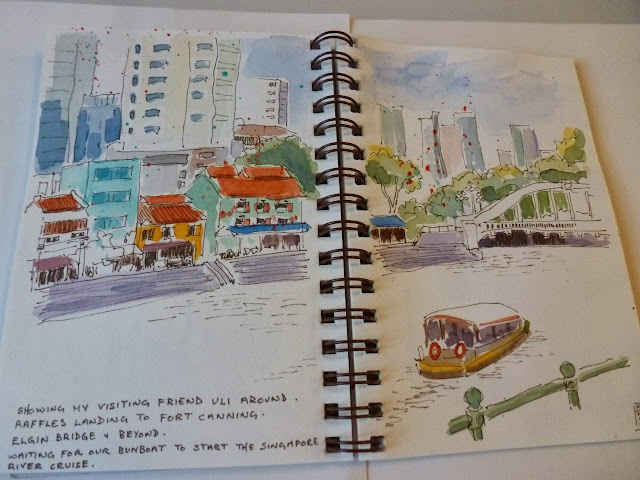
The last time I travelled under Elgin Bridge was in 2013 while on a Singapore River Cruise with some overseas friends and I see the colours of the buildings on the other side of the river were much more colourful then. 

Here's my on-location sketch from near the same spot in 2013.


The two earliest bridges built at this site were wooden footbridges, followed in 1862 by an iron bridge. This was named Elgin Bridge after James Bruce, 8th Earl of Elgin, a colonial administrator and diplomat who had served as Governor of Jamaica, Governor-General of Canada and Viceroy of India. The current concrete bridge was built in 1929.

An Italian sculptor Cavaliere Rudolfo Nolli, designed the cast iron lamps on both sides of the bridge. 

Interestingly the two roads leading to Elgin Bridge are named North Bridge Road and South Bridge Road. Stamford Raffles, Founder of Singapore issued an instruction in 1819 that a bridge be built as soon as possible across the Singapore River so that it may link a town planned for the Chinese community on the southern side of the river to another intended for the Malays on the northern side!

I'm pleased to learn that Elgin Bridge (together with Anderson Bridge and Cavanagh Bridge and collectively known as The Singapore River Bridges) are gazetted a National Monument of Singapore.

To read my post of my earlier 2013 sketch and trip to the Singapore River see:

http://nowismystoryinsketches.blogspot.com/2013/11/elgin-bridge-and-beyond_12.html

#Sailorfude pen, watercolour, #MoleskineWatercolourNotebook, 8.25”x 5"(portrait.